Satellite- and airborne remote sensing offers a great deal of geophysical data and methods for monitoring and analysis.
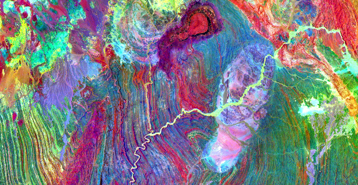
Recent developments allow very detailed mapping of minerals/rocks/soils, of construction material, of vegetation or of enegetic levels (e.g. temperatures, gradients etc) above, at or close below the Earths surface. Aeromagnetic and aeroelectric remote sensing data allows a look into the earth to detect and define for example ore bodies.
Remote sensing also provides very detailled topographic information which can be used for gradient analysis and various modelling as drainage analysis for exploration and reconnaisance, for erosion analysis, flood modelling or infrastructural plannings. Contrary to point data acquired in the field, remote sensing supplies areal data for small and large scale analysis of more or less natural as well as man-made landscapes. Among the latter are districts affected by mining, any kind of waste deposition or urban areas.
By help of Geographic Information systems and case specific software, thematic maps, digital elevation and landscape models derived from remotely sensed data are further analyzed together with cadastral maps, entrepreneurial maps/sketches and information from databases of various sources. 3-D modelling allows the volumetric analysis of ore bodies, dumps, tailings or the management of mining areas in general. Geochemical mineralogical data derived from remotly sensed data or from field samples are modelled to define raw material occurences.
Our services
Data search, selection and order of data, processing of data and production of thematic maps from remote sensing and other data for governmental and entrepreneurial plannings.
Data search, selection, order and interpretation of governemental, administrative and commercial data and maps.
Digitizing of analoguous data lists, maps, sketch maps etc. and data assimilation in new or existing databases.
Planning and implementation of project- or enterprise-related Geographic Information Systems, databases and virtual 3-D worlds for analysis and plannings.
Analysis of data for infrastructural, environmental and urban planning and risk analysis..
Exploration for raw materials. Detection of occurences, quality assessment from remotely sensed data and in the field. Reserve estimations and infrastructural analysis for mining opportunities.
Monitoring of mining sites.